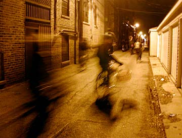
If the street network of the city represents its arterial travel system for people and goods, then the alleys and connected sidewalks represent its smallest capillaries which run directly to the back doors of over a million households, delivering groceries and sustenance to the city population. Chicago has more alleys than any other city in the world, with over 1900 miles of inner-block alleyways! The nearest competitor is Dallas, at roughly 1100 miles. The Rat Patrol believes that alleys are the ideal avenues of travel throughout the city. In fact we have a plan to remove all streets and replace them with alleys in order to create a utopian democratic society.
Most blocks of Chicago are laid out on a grid system with occasional diagonal streets cutting through. Through most of the city there is a major street every half mile or every four blocks. The point of origin for all street numbers is the intersection of State and Madison. From here every point throughout the city can be identified by its coordinates north, south, east or west. Outside of the older parts of downtown, the street numbers increase by 100 with each block, so that there are 800 street addresses per mile. But how do the alleys fit into this? Can a door off alley be considered to have a real address when the alley itself has no official name? There are a number of such places which may exist outside this official address system. Unlike the rest of Chicago's streets with their right-angled directions, the alley represents a non-cartesian connection between disparate places, a spatially undefined public way which allows transportation without reference to the normal city street plane. Some glimpses of life in the alley: Alley Gallery of street signs Alley Tour of secret places |
![]()